Intense cold wave to grip northwest India till January 4
Winters have been relatively warm over most parts of north India, except for the latter part of December when regions of north and northwest India experienced cold wave and dense fog conditions.
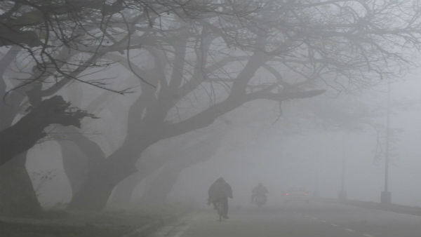
New Delhi, Jan 01: Most parts of northwest India, including Uttarakhand, Punjab, Haryana and Uttar Pradesh set to be under the grip of cold wave in the first week of 2023.
The India Meteorological Department has said isolated pockets over Uttarakhand, Punjab, Haryana, Chandigarh, Uttar Pradesh and western Madhya Pradesh are expected to experience cold day conditions over the next two days.

Fog is common at this time of the year due to light winds and high moisture near the surface over the Indo-Gangetic plains.
The cold winter conditions lead to condensation of moisture and formation of tiny liquid droplets that hang in the air.
Due to north-westerly winds from the Himalayas over plains of northwest India, minimum temperatures are very likely to fall by 2-4 degrees Celsius over northwest and adjoining central India during the next two days, the India Meteorological Department said.
Under its influence cold wave to severe cold wave conditions are likely over the northern parts of Rajasthan till Tuesday.
Delhi and adjoining areas had a brief respite from cold wave conditions last week.
Winters have been relatively warm over most parts of north India, except for the latter part of December when regions of north and northwest India experienced cold wave and dense fog conditions.
The weather office has attributed the missing cold conditions over north India to the lack of strong western disturbances, or extra tropical weather systems, that bring rains to the plains and snowfall at higher altitudes.
This December, there were seven western disturbances, of which six were feeble over India and only one (December 28 - 30) was strong. The latest extra tropical weather system brought the season's first snowfall and rainfall over upper reaches of Jammu and Kashmir, Himachal Pradesh and Uttarakhand during the last three days.
The weather office has forecast 86 per cent below normal rainfall of the long period average (LPA) over northwest India between January and March. The LPA of rainfall over northwest India for January-February-March is about 184.3 mm.
"If rainfall is indicated to be low, then it means that western disturbance activity is likely to be low. When there are fewer western disturbances, north-westerly winds may continue to blow over certain parts of northwest India," IMD Director General Mrutyunjay Mohapatra said on Saturday.
He said minimum and maximum temperatures may be low over Madhya Pradesh, southern Uttar Pradesh, east Rajasthan, and adjoining areas.
States like Haryana and Punjab likely to witness normal temperature, while it could be above normal over higher areas like Himachal Pradesh and Jammu and Kashmir.


 Click it and Unblock the Notifications