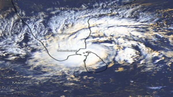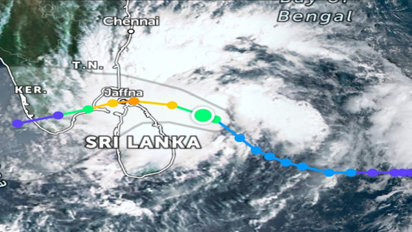
What is the path of cyclone Burevi; Check satellite images here
New Delhi, Dec 03: Cyclone Burevi over Sri Lanka moved west-northwestwards with a speed of 12 kmph during past six hours and lay centred about 60 km northwest of Trincomalee, 180 km east-southeast of Pamban, said the IMD early hours of Thursday.

It moved west-northwestwards with a speed of 11 kmph during past six hours and lay centered at 0830 hrs IST of 3 December over north Sri Lanka and about 30 km east-northeast of Mannar, 110 km east-southeast of Pamban (India) and 310 km east-northeast of Kanniyakumari (India). It is very likely to move west-northwestwards and emerge into Gulf of Mannar during next 3 hours.
On Thursday noon, Burevi will be centred close to Pamban, initially from Ramanathapuram district and then gradually from Kanniyakumari district.

Burevi
is
moving
towards
the
coast
of
southern
Tamil
Nadu
and
is
likely
to
make
landfall
between
Kanniyakumari
and
Pamban
during
tonight
and
early
morning
tomorrow.
The
Cyclone
is
forecast
to
cross
the
coast
of
Tamil
Nadu
while
carrying
winds
with
a
speed
of
70-80
kmph,
gusting
to
90
kmph.

It is likely to weaken by the time it crosses the Gulf of Mannar and turns back to hit Kerala and parts of Tamil Nadu, but will still be powerful.

"The Cyclonic Storm with wind speed of 70-80 gusting to 90 kmph would be centered very close to Pamban around noon of 3rd December. It would then move nearly west-southwestwards across Pamban area by afternoon and cross south Tamil Nadu coast between Pamban and Kanniyakumari during 3rd December night and 4th December early morning as a Cyclonic Storm with wind speed of 70-80 gusting to 90 kmph," the IMD said in the morning bulletin.


 Click it and Unblock the Notifications


